Connecting the Tactical Edge: Integrating DTC SDR Mesh Radio, Aerius UAS and SIGTRACK
Modern defence, border-security, emergency-response and public-safety operations increasingly depend on the rapid movement of reliable information. Commanders must be able to see what is happening beyond their immediate position, communicate with deployed personnel and respond quickly when an operator, patrol or civilian is in danger.
The integration of DTC Software-Defined Radio mesh communications, the Aerius Uncrewed Aircraft System and the SIGTRACK personnel-tracking platform provides a practical framework for creating this connected operational environment.
Rather than functioning as separate technologies, the three systems can be combined into a unified command, control, communications, computing, intelligence, surveillance and reconnaissance capability. The resulting architecture connects aerial surveillance platforms, ground teams, vehicles and command centres through a resilient tactical data network.
DTC SDR Mesh Radio: The Communications Backbone
DTC, a Codan company, develops mission-critical communications equipment for military, public-safety, uncrewed-system and specialist operational environments. Its tactical mesh solutions are designed to establish wireless Internet Protocol networks without depending entirely on fixed telecommunications infrastructure.
At the centre of the system is the Software-Defined Radio, or SDR. Unlike a conventional radio whose functions are largely fixed by its hardware, an SDR can support different waveforms, network configurations and operational capabilities through software.
DTC’s MeshUltra waveform family operates as a Mobile Ad Hoc Network, commonly known as a MANET. In this architecture, each radio functions as both a communications terminal and a network node. The network can therefore form automatically as radios are activated and reorganise itself as personnel, vehicles and aircraft move. DTC describes its mesh architecture as self-forming and self-healing, enabling communications paths to be re-established when network conditions change or an individual node becomes unavailable.
Depending on the selected radio, waveform, frequency allocation and configuration, the network can carry:
-
- Live video from electro-optical and infrared cameras;
- Aircraft telemetry and command-and-control data;
- Personnel location information;
- Voice communications;
- Sensor information;
- Maps, photographs and mission files;
- Emergency alerts; and
- General Internet Protocol data.
DTC’s BluSDR family is specifically designed to support uncrewed aerial, ground and maritime platforms. Official product information states that the family includes lightweight original-equipment-manufacturer modules for smaller aircraft and ruggedised nodes for vehicles and control stations. Available configurations cover frequencies from approximately 340 MHz to 6 GHz, while selected MeshUltra configurations can support networks containing as many as 144 radios and aggregate data throughput of up to 87 Mbps. Actual performance depends on configuration, spectrum availability, terrain, antenna selection, interference and operational conditions.
For dismounted personnel, the Sentry Mesh 6161 provides a compact personal radio with integrated Global Positioning System capability. The platform can distribute position-location information across the tactical network and supports optional AES-256 encryption. It is also designed and tested against relevant provisions of MIL-STD-461G and MIL-STD-810H for environmental and electromagnetic performance.
Aerius UAS: The Airborne Intelligence and Network Node
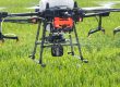
The Aerius UAS, developed as part of SokoAerial Robotics’ unmanned-systems capability, can serve as the airborne component of the integrated architecture.
Equipped with an appropriate electro-optical or infrared payload, the aircraft can provide commanders with an elevated view of operational areas that may be difficult, dangerous or time-consuming for ground teams to access.
Potential missions include:
-
- Border and perimeter surveillance;
- Search-and-rescue operations;
- Critical-infrastructure inspection;
- Route reconnaissance;
- Convoy overwatch;
- Disaster-area assessment;
- Wildlife and environmental monitoring;
- Public-safety support; and
- Intelligence, surveillance and reconnaissance.
When fitted with a compatible DTC airborne mesh radio, Aerius can transmit live video, telemetry and sensor information directly to authorised users on the tactical network. The same network may carry commands from the ground-control station to the aircraft, subject to the aircraft’s approved command-and-control architecture.
This arrangement reduces the need to operate separate communications links for telemetry, video and operational data. It also allows imagery from the aircraft to be viewed by more than one authorised user, including commanders, vehicle crews, observation posts and personnel carrying suitable end-user devices.
Airborne Network Extension
One of the most important potential roles of Aerius is to operate as an airborne communications relay.
Radio performance is strongly affected by terrain, buildings, vegetation and the availability of a clear line of sight. Ground teams operating behind hills, inside valleys or around dense infrastructure may therefore experience reduced connectivity.
Placing a mesh node on an aircraft increases the node’s elevation and may improve line-of-sight connectivity between separated ground elements. The aircraft can consequently act as a temporary communications bridge or range-extension node between:
-
- Patrol teams and the command centre;
- Personnel operating on opposite sides of an obstruction;
- Ground vehicles and dismounted operators;
- Emergency responders spread across a disaster area; and
- Remote sensors and operational headquarters.
DTC identifies airborne rebroadcast and range extension as recognised applications for its uncrewed-system communications technology.
The aircraft does not replace every requirement for terrestrial infrastructure, satellite communication or high-frequency radio. Instead, it introduces a rapidly deployable network layer that can be positioned where coverage is most urgently required.
SIGTRACK: Personnel Safety and Situational Awareness
While Aerius provides intelligence from the air, SIGTRACK provides information about personnel and operational activity on the ground.
SIGTRACK is conceived as a connected tracking and safety platform that can operate through wearable devices, smartphones and command applications. Depending on the deployed equipment and authorised configuration, it can collect and display information such as:
-
- User identity or operational callsign;
- Current geographical position;
- Direction and speed of movement;
- Route travelled;
- Time of the most recent update;
- Device and battery status;
- Distress or emergency condition;
- Geofence entry and exit events; and
- Relevant physiological information from supported wearable sensors.
The command interface can present personnel positions on a shared operational map. Normal operators can be displayed with standard markers, while a distress activation can produce a prominent visual and audible warning.
SIGTRACK may also support coordinates in formats such as decimal degrees, degrees-minutes-seconds and Military Grid Reference System notation. This assists interoperability between civilian agencies, military users, aviation teams and emergency services that may use different coordinate standards.
Emergency Response Through the Mesh Network
The integration becomes particularly valuable when a user activates an emergency signal.
A representative operational sequence would be:
-
- A deployed operator activates the SIGTRACK distress function through a wearable device or connected application.
- The device records the operator’s identity, position, time and available status information.
- The emergency packet is transmitted through the DTC mesh network.
- Nearby mesh nodes automatically relay the information towards the command centre.
- The command interface displays the operator as being in distress.
- Aerius is tasked to fly towards the reported location.
- The aircraft transmits live imagery of the area to the command team and responding units.
- The nearest available patrol or rescue element is directed towards the casualty.
- The command centre continues monitoring the responder, distressed operator and aircraft on the same operational picture.
This creates a connected response chain extending from emergency activation to aerial observation, command decision-making and deployment of assistance.
A Shared Operational Picture
The greatest advantage of the integrated system is not any individual radio, aircraft or software application. Its principal value lies in creating a shared operational picture.
A commander could simultaneously observe:
-
- The location of deployed personnel;
- The route followed by each patrol;
- Active distress alerts;
- The position and status of Aerius;
- Live aerial video;
- Ground-camera feeds;
- Vehicle locations;
- Operational boundaries and geofences;
- Identified hazards; and
- The availability of communications nodes.
Information can therefore move from the sensor to the decision-maker and then to the responding unit without requiring several disconnected systems.
This can shorten the time required to understand an incident, verify a threat and deploy the appropriate response.
Operational Applications
Border Security
Aerius can inspect routes, crossing points and difficult terrain while SIGTRACK monitors patrol positions. DTC mesh nodes connect the aircraft, patrol teams, vehicles and command posts, including in areas with limited commercial telecommunications coverage.
Search and Rescue
Rescue personnel can be monitored while the aircraft searches a wider area using daylight or thermal imaging. Once a missing person or hazard is identified, coordinates and imagery can be distributed across the mesh network.
Disaster Management
Following floods, earthquakes, fires or infrastructure failures, conventional communications may become congested or unavailable. A deployable mesh network can connect response teams, while Aerius provides aerial assessment and SIGTRACK monitors responder safety.
Military Operations
The integrated system can support reconnaissance, force protection, convoy overwatch, tactical movement, casualty response and command-post situational awareness. Sensitive military deployments would require approved security architectures, key management, spectrum planning and operational security procedures.
Critical-Infrastructure Protection
Security teams responsible for ports, energy installations, pipelines, airports and telecommunications facilities can combine aerial inspection with real-time personnel and incident tracking.
Security and Resilience
A tactical network must protect both the information being transmitted and the people whose locations are being monitored.
DTC platforms support security capabilities including AES-256 encryption on selected configurations. DTC also states that its broader mission-ready equipment portfolio includes IP68-certified, MIL-STD-qualified and hardware-encrypted solutions, although the exact certification and protection level must be confirmed for each selected device.
A complete deployment should additionally include:
-
- Role-based access control;
- Secure authentication;
- Encryption-key management;
- Device registration and revocation;
- Protection of stored location data;
- Audit logging;
- Defined data-retention periods;
- Lost-device procedures;
- Spectrum and interference monitoring;
- Backup command-and-control methods; and
- Compliance with national aviation, telecommunications and data-protection requirements.
The mesh network should be treated as one part of a layered communications architecture rather than as the only available communication method.
An Integrated Capability for African Operational Environments
The combination of DTC SDR mesh communications, Aerius UAS and SIGTRACK offers particular value in operational environments where infrastructure is limited, terrain is challenging and teams must cover extensive geographical areas.
For African defence, border-security, disaster-management, environmental-protection and public-safety organisations, the architecture provides a pathway towards locally integrated situational awareness without requiring every operation to depend entirely on public cellular networks.
DTC provides the resilient communications layer. Aerius provides aerial observation and potential network extension. SIGTRACK connects personnel safety, movement and emergency information to the command structure.
Together, the technologies can transform separate radios, drones and wearable devices into a coordinated operational system.